


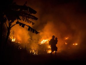
Lembata, MINA – More than 4,000 residents evacuated after the eruption of Mount Ili Lewotolok in Lembata District, East Nusa Tenggara (NTT).
They are scattered in seven points of refuge.
“The Lembata District Disaster Management Agency (BPBD) recorded 4,628 people displaced at seven points as of Monday,” said Head of Disaster Data, Information and Communication Center for the National Disaster Management Agency (BNPB) Raditya Jati on Monday, as quoted from Anadolu Agency (AA).
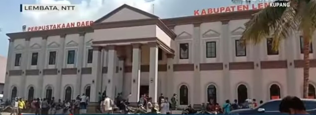
Raditya said that there were 3,672 refugees scattered in refugee posts in the old regent’s office, the BKD PSDM Office 338, Tapolangu 287, Ankara Hall 148, Lewoleba Tengah 140, Harnus 28, and Baopana Village 15.
Also Read: Religious Leaders Spearhead Tropical Forest Preservation Efforts
When the eruption occurred, he admitted that the local BPBD immediately evacuated residents.
In addition, said Raditya, BPBD is evacuating residents from several villages.
The NTT Provincial BPBD helps the local government (pemda) to form a command post to carry out emergency response efforts.
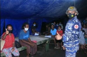
In addition to evacuation, the emergency handling carried out by the regional government is in the form of handling displaced residents, health services and helping public kitchens and the provision of clean water.
Also Read: BNPB Focuses on Forest and Land Fires in Sumatra and Java
“Based on a quick assessment in the field, the urgent need for emergency handling is in the form of evacuation tents, water supply and sanitation, baby and toddler needs, masks, blankets, sleeping mats and tarpaulins as well as personnel support for children’s assistance,” said Raditya.
Raditya conveyed that the regional government is trying to implement health protocols in handling evacuations.
To support health protocols, BPBD requires personal protective equipment, such as masks.
Furthermore, he quoted information from the Center for Volcanology and Geological Disaster Mitigation (PVMBG) which delivered several recommendations related to the increase in the volcanic status of Mount Ili Lewotolok.
Also Read: Presidential Communications Chief Invites Public to Witness Pacu Jalur
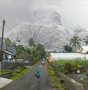
First, people around the mountain or visitors, climbers or tourists do not carry out activities within a 4 kilometer (km) radius of the summit crater.
Second, the use of masks and other equipment to protect the eyes and skin. This is recommended to avoid the impact of volcanic ash which causes acute respiratory problems and other health problems.
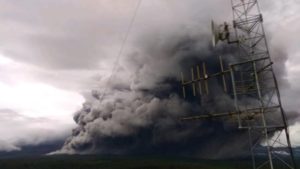
Third, PVMBG reminds that volcanic ash is currently falling in several sectors around Mount Ili Lewotolok.
Therefore, people who live around the rivers that head up this mountain are to be aware of the potential danger of lava, especially in the rainy season.
Also Read: MUI Supports Sanctions Against Welfare Recipients Engaged in Online Gambling
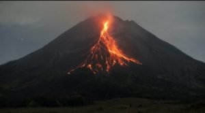
Raditya added the potential danger of Mount Ili Lewotolok in the form of throwing rocks or incandescent lava in all directions, heavy ash rain whose distribution is influenced by wind direction and speed, hot clouds, especially towards the crater opening which is on the southeast side.
In addition, he mentioned other dangers in the form of avalanches of weathered material in the summit crater to the southeast as well as lava in rivers that originate from the top of the mountain.
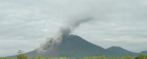
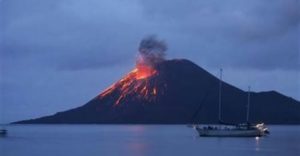
Previously, Mount Ili Lewotolok volcano in Lembata Regency, East Nusa Tenggara Province experienced an eruption on Sunday at 09.45 local time.
The eruption column was 4,000 meters high above the summit.
Also Read: Taiwan Promotes Muslim-Friendly Tourism, Highlights Services at Jakarta’s International Islamic Expo
Based on the PVMBG monitoring, it is observed that the thick gray ash column is leaning east and west. (T/RE1)
Mi’raj News Agency (MINA)
Also Read: Transjakarta Uses AI to Boost Ridership


 Mina Indonesia
 Mina Arabic