


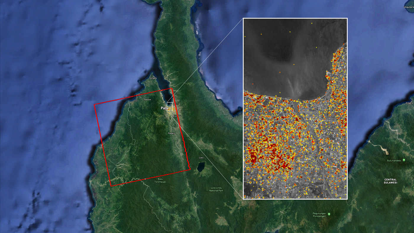

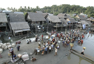
Pasadena, MINA — A 7.5-magnitude earthquake on Sept. 28 in northern Indonesia and the devastating tsunami that followed it killed more than 1,400 people and left a large trail of destruction.
This map, produced by NASA’s Advanced Rapid Imaging and Analysis (ARIA) team, shows that damage. The map covers an area of about 42 by 44 miles (67 by 70 kilometers), shown by the red polygon, Nasa-JPL reported.
Each pixel measures about 33 yards (30 meters) across. The color variation from yellow to red represents increasingly more significant ground surface change, or damage likely caused by the earthquake and tsunami.
Preliminary validation of the satellite data was done in collaboration with the Earth Observatory of Singapore by comparing with local media information and photos
Also Read: BRIN Officially Launches InaRI Expo 2025
Although the data is less accurate over dense vegetation, images like this one help governments and responders to identify areas that experienced significant damage and to allocate resources accordingly.
The damage proxy map was created by NASA-JPL/Caltech’s ARIA team using ALOS-2 satellite SAR data. The ALOS-2 data were provided by JAXA.
The Earth Observatory of Singapore coordinated with Sentinel Asia to timely task the ALOS-2 satellite. The algorithm development was carried out at JPL under a contract with NASA. (T/RS5/RS1)
Mi’raj Islamic News Ageny (MINA)
Also Read: “Free Palestine” Echoes at Prambanan Jazz Festival 2025


 Mina Indonesia
 Mina Arabic