


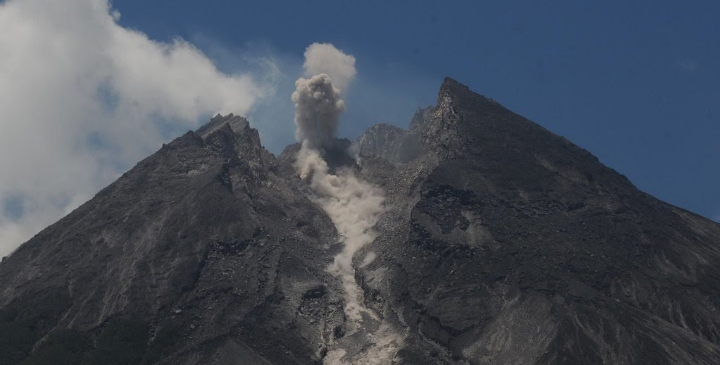

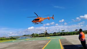
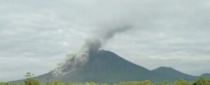
Yogyakarta, MINA – The Regional Disaster Management Agency (BPBD) of the Yogyakarta Rapid Response Team (TRC) monitored the development of Mount Merapi’s activities by helicopter on Friday.
It was carried out in order to monitor the area so that further steps can be taken in relation to disaster mitigation for people living on riverbanks that are upstream on the slopes of Mount Merapi.
“For us, as an evaluation material for community mitigation on the riverbanks that originate on the slopes of Mount Merapi,” said Endro Sambodo, BPBD DI Yogyakarta TRC Team.
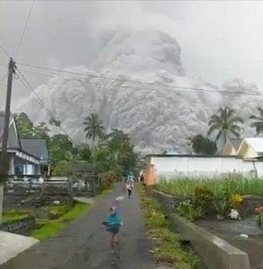
As for the results of the aerial monitoring, Endro said that there was a lot of new landslide material from the top of the mountain.
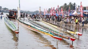
Also Read: Jordanian YouTuber Joe Hattab Arrives in Kuansing to Witness Pacu Jalur
“At first glance, there is a lot of new landslide material,” said Endro.
According to him, the landslide led to a slope which predominantly headed west and southwest.
Meanwhile, from the morphology of the landslide material, it leads to the upper reaches of Kali Senowo, Kali Putih and Kali Lamat.
Endro also reported that for the southwest region, there were some materials on the slopes leading into the upstream of Kali Boyong and Kali Krasak.
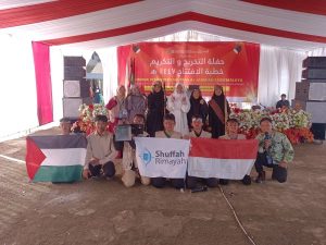
Also Read: BKSAP Establishes Indonesia-Palestine Friendship Society
Meanwhile, on the southeast side upstream of Kali Gendol, there is an avalanche of new material. The provisional estimate of the landslide comes from the crater opening in the west wall.
For further study, TRC BPBD DIY then reports the results of the monitoring to the Center for Geological Disaster Research and Technology Development (BPPTKG) for further analysis.
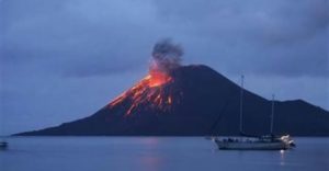
Drops of Old Material
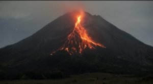
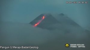
BPPTKG head Hanik Humaida found traces of avalanche material from the 1998 eruption of Mount Merapi on the west side leading to Kali Senowo and Kali Lamat, as well as the remaining lava from the 1948 eruption, while conducting aerial monitoring using a BNPB helicopter on Thursday.
Also Read: Dutch Hiker Evacuated by Helicopter After Fall on Mount Rinjani
Hanik also saw an avalanche of old material in the craters from the outside and towards the west side.
“From the aerial monitoring, we can see traces of avalanche material on the west side, namely in the 1998 Lava (remnants of the eruption) leading to the upper reaches of Kali Senowo and Kali Lamat, as well as in Lava (remnants of the 1948 eruption). said Hanik on Thursday.
Based on provisional predictions from observations, according to Hanik, the potential danger still leads to the Gendol River.
Furthermore, Hanik also estimated that the avalanche of material from Mount Merapi’s activities this year could potentially lead to the upstream flow of Kali Senowo and Kali Lamat. However, his party has not been able to determine with certainty the direction of the flow.
Also Read: Islamic Boarding School in Tasikmalaya Stage Theatrical Performance to Voice Support for Palestine
“That old material fell to the northwest, namely the Senowo River and the Lamat River, but it is still upstream. Meanwhile, for potential hazards, the direction is still to the Gendol River, “explained Hanik.
“But seeing the avalanches also happening in the northwest, then there is also potential in that direction. It’s just that we still can’t determine the exact direction, “he added.
Furthermore, Hanik Humaida also hopes that the results of these observations can then provide an overview of policy makers to make good decisions, in terms of disaster risk reduction and strengthening of othe capacities. (T/RE1)
Mi’raj News Agency (MINA)
Also Read: 100 Boats to Compete in Pacu Jalur Boat Race in Kuantan Singingi


![Activists drop a banner from Westminster Bridge, calling on Labor leader Keir Starmer to say he'll end arms sales to Israel if he becomes prime minister, on 3 June 2024, in London, Uk [Luca Marino]](https://en.minanews.net/wp-content/uploads/2024/08/IMG_20240825_103542-300x190.jpg)


 Mina Indonesia
 Mina Arabic