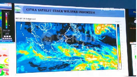
Jakarta, MINA – The Head of Public Meteorology Center, Andri Ramdhani said based on BMKG observations, there is a low-pressure area in the waters west of the Philippines (potential Tropical Cyclone 91W) and in the northern Philippine Sea off Papua (potential Tropical Cyclone 92W).
Therefore, they advised the public to be aware of strong winds in several regions of Indonesia.
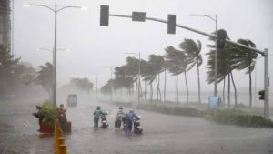
“To the people in areas experiencing strong winds, we urge you to remain vigilant and be prepared. Especially when driving as strong winds can cause billboards and trees to fall or dangerous materials to be blown around,” Andri said in Jakarta on Friday as reported by MINA.
He explained that this low-pressure area forms a convergence zone and slows down wind speeds (convergence) extending from the western part of the Philippine Sea, Sulawesi Sea to the eastern waters of the Philippines.
Also Read: UAR Deploys 14 Volunteers to Aceh for Search, Rescue and Humanitarian Response
Another convergence zone was observed in the Malacca Strait, South China Sea, Central Kalimantan, East Kalimantan, North Kalimantan, western part of North Sulawesi, Seram Sea, Arafura Sea, and the northern Pacific Ocean off Papua.
“This condition can increase the potential for rain cloud growth around the low-pressure area and along the convergence zone,” he said.
The phenomenon of dry air intrusion from BBS crossing through South Sulawesi, Southeast Sulawesi, and Maluku regions, which can lift moist air ahead of the intrusion boundary, becoming warmer and more humid in central Sulawesi, Maluku, and Papua.
Andri added that wind speeds exceeding >25 knots were also observed in the Andaman Sea, South China Sea, southwest Indian Ocean, southern West Java, central and eastern Java Sea, Flores Sea, Banda Sea, Seram Sea, Halmahera Sea, and Maluku Sea , which can increase wave heights in the surrounding waters.
Also Read: BNPB Deploys Aircraft to Deliver Emergency Aid to Flood-Hit Areas in Aceh
Meanwhile, strong Local Instability supporting convective processes at the local scale was observed in Aceh, North Sumatra, South Sumatra, Bengkulu, North Kalimantan, East Kalimantan, Central Sulawesi, West Papua, Central Papua, Papua, and Papua Highlands.
In general, the combination of these weather phenomena is predicted to cause significant weather potential during the period of July 18-25, 2024. This includes moderate to heavy rain accompanied by lightning and strong winds in West Sumatra, North Kalimantan, Southeast Sulawesi, Maluku , Southwest Papua, Central Papua, and the Papua Highlands.
“These conditions also have the potential to cause strong winds in Banten, West Java, NTB, NTT, West Sulawesi, South Sulawesi, Southeast Sulawesi, Maluku, West Papua, and Central Papua,” he explained. (T/RE1/P2)
Mi’raj News Agency (MINA)
Also Read: MER-C Medan Deploys Medical Team to Support Flood Victims in Sumatra











 Mina Indonesia
 Mina Arabic