


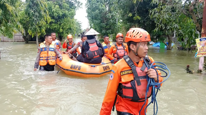

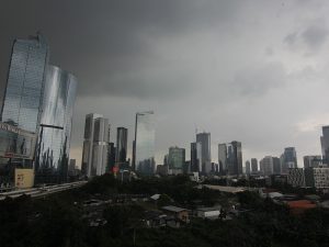
Jakarta, MINA – Heavy rainfall accompanied by lightning and strong winds has hit large parts of Grobogan Regency, Central Java, since Tuesday, marking the beginning of Indonesia’s rainy season. Within hours, previously calm rivers overflowed, flooding several areas across the region.
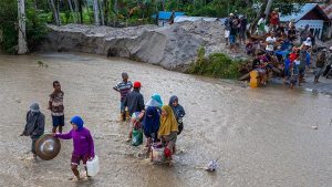
The Regional Disaster Management Agency (BPBD) of Grobogan reported that the flooding affected 21 villages in 11 districts, including Geyer, Tanggungharjo, Tegowanu, Kedungjati, Gubug, Klambu, Kradenan, Purwodadi, Godong, Penawangan, and Toroh.
“A total of 2,095 households have been affected so far, and data collection is still ongoing,” said Abdul Muhari, Head of the Disaster Data and Information Center at the National Disaster Management Agency (BNPB), on Thursday (October 23).
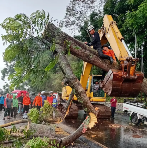
Preliminary assessments found that 2,095 homes were inundated, along with a mosque, a school, a village hall, and two fallen trees. Two levees were breached, one bridge collapsed, and around 205 hectares of farmland were submerged.
Also Read: Densus 88 Confirms Jakarta School Explosion Was Not Terror-Related
The flooding also temporarily disrupted the Jakarta–Surabaya railway line in Gubug District, but operations have since resumed.
Emergency teams from BPBD, the Indonesian Military (TNI), National Police (Polri), Social Affairs Office, Indonesian Red Cross (PMI), and community volunteers have been working to evacuate residents and clear debris from blocked roads and bridges. Most floodwaters have receded, though some areas in Purwodadi District remain inundated at depths of 20–50 centimeters.
The Central Java BPBD continues to monitor the situation and coordinate with local authorities. The River Basin Authority (BBWS) and state railway company PT KAI have also repaired damaged levees near the tracks.
Abdul Muhari said the flooding is a reminder of the need for preparedness as the rainy season begins.
Also Read: Police Name Suspect in Jakarta High School Explosion
“Grobogan’s geography and hydrology pose unique challenges. After a long drought, residents now face floods at the start of the rainy season,” he said.
Located between the Kapur Mountains in the north and the Kendeng Mountains in the south, Grobogan lies within two major river basins, the Jratun (Jragung–Tuntang) and Seluna (Serang–Lusi–Juwana), making it highly prone to seasonal flooding.
To mitigate such disasters, the government has built the Kedungombo Reservoir, which holds 723 million cubic meters of water and irrigates around 60,000 hectares of farmland in Grobogan, Demak, Kudus, and Pati.
“Integrated river and irrigation management is crucial. The ‘one river, one management’ principle must go hand in hand with active community participation in environmental protection,” Abdul Muhari concluded.[]
Also Read: At World Peace Forum, Kalla Says ‘No One Wants to Be a Victim of War’
Mi’raj News Agency (MINA)


 Mina Indonesia
 Mina Arabic