


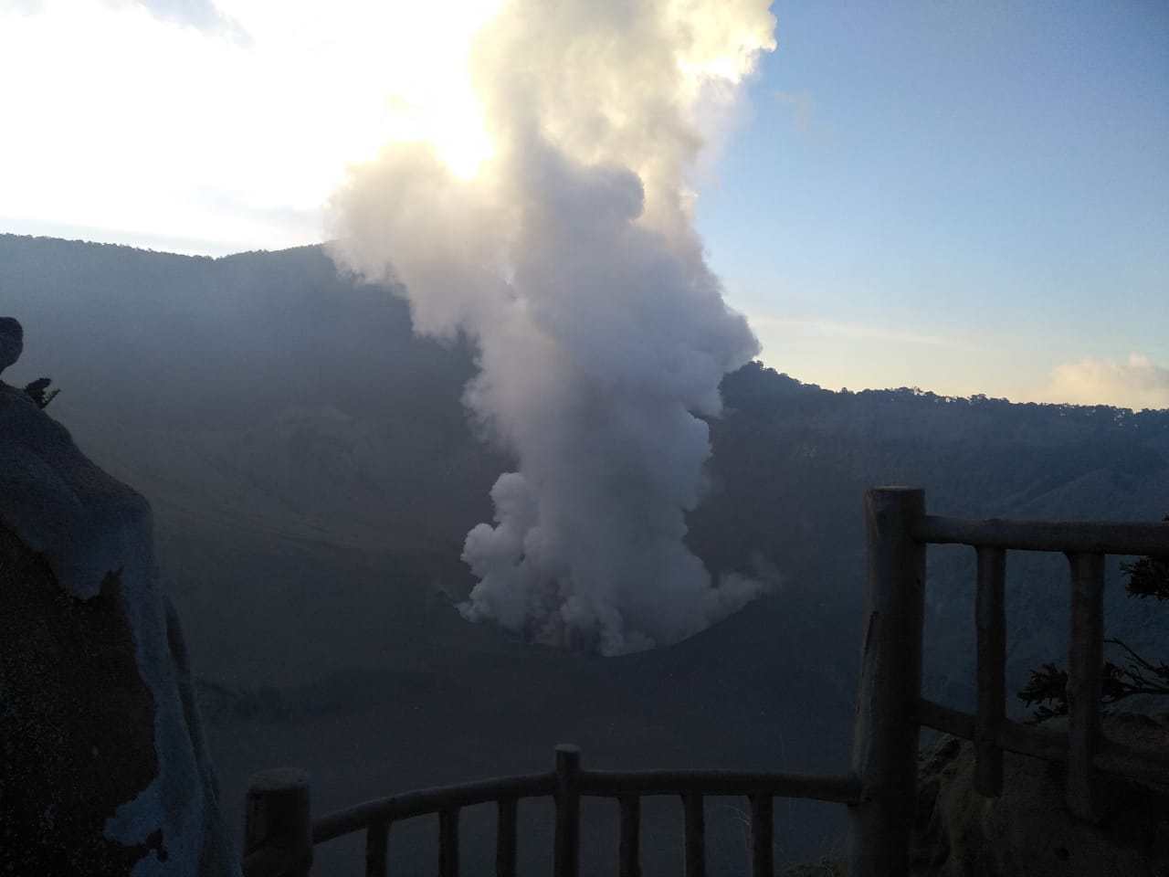

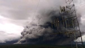
Jakarta, MINA – The local government has closed the Tangkuban Parahu Mountain Tourism Area after the eruption on Friday 26 July at 15.48 PM.
Monitoring of the Center for Volcanology and Geological Disaster Mitigation (PVMBG) falling volcanic ash reaches a radius of 1-2 km. Ash distribution was observed in Jayagiri Village, Lembang District, West Bandung Regency.
The West Bandung District Disaster Management Agency (BPBD) received information from residents in Cisarua Subdistrict that ash was pointing there. While the report from the BPBD, the eruption ash was not visible from the West Bandung BPBD office which is 17-20 km from the mountain.
After the Eruption of Tangkuban Perahu Volcano, the Geological Agency issued a danger warning for aircraft passing around the mountain area or Volcano Observatory Notice for Aviation (VONA).
Also Read: Central Java Partners with 12 European Countries to Boost Low-Carbon Rice Production
The orange VONA notification indicates that ash is still below 1,000 feet. This level can endanger the flight. VONA also mentioned the distribution of volcanic ash to the northeast and south.
Previously PVMBG reported, Mount Tangkuban Parahu, located in Bandung Regency, West Java, erupted on Friday 26 July, at 15:48:18 PM. The ash column is observed with a height of approximately 200 m above the peak.
Thick gray and thick ash leads to the East – North-South. This eruption is recorded on a seismogram with a maximum amplitude of 38 mm and a duration of 5 minutes 30 seconds.
Communities around the mountain to remain calm and not provoked by incorrect issues, and monitor warnings and information from the local government or the local Disaster Management Agency (BPBD). (T/Ais/P2)
Also Read: Indonesia’s Health Ministry Speeds Up Free Screenings for 53 Million Students
Mi’raj News Agency (MINA)


 Mina Indonesia
 Mina Arabic