


Indonesia’s Mount Semeru Erupts, Ejecting Volcanic Ash 1,000 Meters
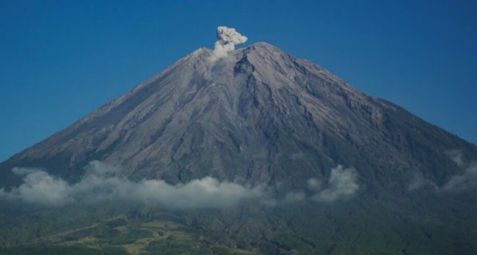
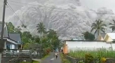
Jakarta, MINA – Mount Semeru experienced an eruption on Tuesday morning, at 06.17 p.m. According to a report by the Center for Volcanology and Geological Hazard Mitigation (PVMBG), the height of the eruption column of Mount Semeru was observed to reach 1,000 meters above the peak, or around 4,676 meters above sea level.
As quoted from Liputan6, the ash column was observed to be white to gray in color with moderate to thick intensity towards the north and northeast. The eruption of Mount Semeru was recorded on a seismograph with a maximum amplitude of 20 mm and a duration of 98 seconds.
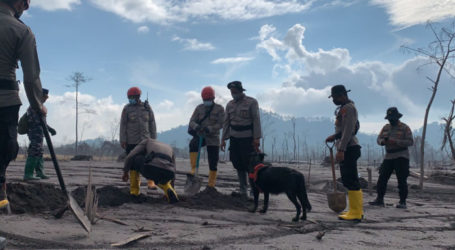
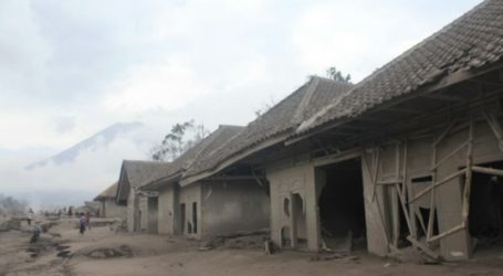
People and tourists who are around the location of Mount Semeru are prohibited from doing any activities in the southeast sector along Besuk Kobokan, as far as 13 kilometers from the peak (center of the eruption).
Beyond this distance, people do not carry out activities within 500 meters of the river bank (river border) along Besuk Kobokan because they have the potential to be affected by the expansion of hot clouds and lava flows up to a distance of 17 kilometers from the peak.
Do not move within a radius of 5 kilometers from the crater/top of Semeru Volcano because it is prone to the danger of throwing rocks (flare).
The public is also advised to be alert to the potential for hot clouds, lava avalanches and lahars along rivers/valleys that originate at the peak of Semeru Volcano, especially along Besuk Kobokan, Besuk Bang, Besuk Kembar and Besuk Sat as well as the potential for lahars in small rivers which is a tributary of Besuk Kobokan.
Throughout 2024, Mount Semeru was recorded to have erupted 159 times. As of today, Tuesday, April 9 2024, at 06.30 p.m, Mount Semeru is still on Alert status (Level III). (T/RE1/P2)
Mi’raj News Agency (MINA)