

ISRAELI OCCUPATION CAUSES FIRE IN GOLAN HEIGHTS
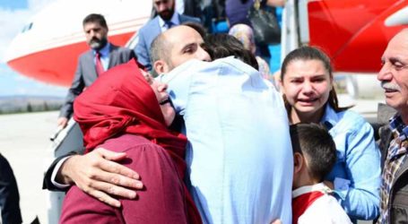
 Quneitra (Golan) , 7 Ramadan 1434/15 July (MINA) – The Israeli occupation authorities deliberately caused a huge fire in an area overlooking the villages of Sehita and Hadar in Quneitra, the Golan Heights.
Chairman of Hadar municipal council, Jaber Abu Hussein said that a huge fire was started by Israel on Sunday and spread from occupied lands near Masada and Sehita villages in their occupied part, adding that the fire burnt hundreds of acres of farmlands.
Abu Hussein added that the occupation started the fire taking advantage of the wind blowing towards the farmlands in Hadar town, according to a report published in www.sana.sy monitored by Mi’raj News Agency (MINA).
The Golan Heights borders Israel, Lebanon, and Jordan. According to Israel, it has captured 1,150 square kilometres (440 sq mi). According to Syria the Golan Heights measures 1,860 square kilometers, of which 1,500 square kilometres (580 sq mi) are occupied by Israel. According to the CIA, Israel holds 1,300 square kilometres (500 sq mi)
The area is hilly and elevated, overlooking the Sea of Galilee, Jordan River and 2,743.2 metres (9,000 ft) tall Mount Hermon.[32] The plateau has an average altitude of 1,000 metres (3,300 ft), an area totaling 1,800 square kilometres (690 sq mi), and straddles the boundary between Syria and Israeli-held territory.
Elevations range from 2,814 metres (9,232 ft) in the north at Mount Hermon, to below sea level along the Sea of Galilee and the Yarmuk River in the south. The plateau that Israel controls is part of a larger area of volcanic basalt fields stretching north and east that were created in the series of volcanic eruptions that began recently in geological terms, almost 4 million years ago, and continue to this day. It has distinct geographic boundaries.
On the north, the Sa’ar valley (Banias) generally divides the lighter-colored limestone bedrock of the mountains from the dark-colored volcanic rocks of the Golan plateau. The western border of the plateau is truncated structurally by the Jordan Rift Valley, which falls down steeply into the lake. The southern border is lined by the Yarmuk River, which separates the plateau from the Hashemite Kingdom of Jordan. Finally, the east end of Golan Heights is carved out by the Raqqad river (Wadi Ruqqad) and areas still controlled by Syria.
In addition to its strategic military importance, the Golan Heights is an important water resource, especially at the higher elevations, which are snow-covered in the winter and help sustain baseflow for rivers and springs during the dry season. The heights receive significantly more precipitation than the surrounding, lower-elevation areas. The occupied sector of the Golan Heights provides or controls a substantial portion of the water in the Jordan River watershed, which in turn provides a portion of Israel’s water supply. The Golan Heights supply 15% of Israel’s water. (T/P04/E1)
Mi’raj News Agency (MINA)